ISSN : 2349-3917
American Journal of Computer Science and Information Technology
Methods of spatial applied statistics in analyzing of regionalized phenomenas
EuroSciCon Conference & Expo on Robotics, Automation & Data Analytics
April 08-09, 2019 | Paris, France
Barbara Namyslowska-Wilczynska and Artur Wilczynski
Wroclaw University of Science and Technology, Wroclaw, Poland
ScientificTracks Abstracts: Am J Compt Sci Inform Technol
Abstract
The results of application of spatial applied statistics methods - geostatistical tools used for modeling, estimating, forecasting and simulating data, i.e. values of parameters describing various regionalized phenomena, analyzed in geological-mining, environmental, geodetic and energy issues, were presented.The following methods were used: linear geostatistics (ordinary kriging, simple kriging, lognomal kriging), quick interpolation techniques (linear model kriging, inverse distances) and non-linear geostatistics (kriging with external drift, bundle indicator kriging, conditional turning bands simulation). The subject of spatial analyses were various problems. It is possible to mention the development of spatial models of polymetallic Cu ore deposits variability, occurring in the Lubin-Sieroszowice region (SW Poland), anisotropy of variation in deposit parameters, uncertainty estimation, risk assessment, determination of the probability zones of exceeding the assumed thresholds for deposit parameters, the filtering of the components of theoretical variograms models of Cu ore deposits parameters, as well as variability of porphyry copper deposits parameters in Peru (Rio Blanco). Geostatistical methods were also used in environmental studies. The subject of interest was the integration of environmental data (concerning soils and groundwater, heavy metals content), estimation of the contamination of soil layers (surface, subsurface) with heavy metals and the determination of anomalous heavy metal content zones, shown for some regions of the southern part of Poland , environmental risk assessment, variability of technological parameters of ash-slags (near Torun, Poland). Quite different a new application was development of spatial and spatio-temporal (2D, 3D) hydrogeochemical models of variation of underground waters quality parameters for a water intake area, and also of a treated water and in water supply system. An interesting experience was the adaptation of geostatistics to analyses related to agriculture and enzymology, to assess the state of spatial distribution of selected enzymes in the surface layer of land, shown against the background of geological-engineering conditions in the Warmian-Masurian region, NE part of Poland. The application of geo-statistical methods to modeling, estimating and forecasting displacements on the basis of data from the geodetic monitoring, also allowed to create spatial models (3D) for a large hydrotechnical object, extremely useful and important, due to its state of safety (SW part of Poland). An extremely innovative area was an attempt to adapt geo-statistical methods to solve issues related to energy, and also located on border of energy and economics. We should mention here the modeling, estimation and forecasting of electrical loads in the 220, 400 kV transmission network and 110 kV grid, as well as modeling and estimating marginal costs of electricity transmission to transmission network nodes at different time points (season, day) for a whole territory of Poland. Areas of application of methods of applied (spatial) statistics are still increasing, practically unlimited. Reaching for such tools also determines the constantly increasing amount of data. This requires the use of effective tools for their processing and geostatistics are undoubtedly one of them.
Biography
Professor Barbara Namys�?�?owska Wilczy�?�?ska-graduate degree from the Faculty of Natural Sciences, discipline- geology at the University of Wroclaw, Poland (1970). She received the degree of Doctor of Technical Sciences (PhD), in a scientific discipline - engineering geology, mining, in 3.05.1980 y., defending a doctoral dissertation entitled. "Quantitative analysis of spatial variability of parameters of geological sediments of the lower Zechstein (Permian) in the area of the mine Lubin", the Institute of Geotechnical Engineering, Wroclaw University of Science and Technology, Poland. In 10.10.1994 y., completed habilitation at the Faculty of Geology, Geophysics and Environmental Protection, University of Science and Technology in Cracow, Poland, based on the dissertation entitled. Prof. B. Namys�?�?owska-Wilczy�?�?ska was approved by the Presidium of the Central Control Commission in Warsaw, in 27.03.1995. In 30.12.2009 y. President Lech Kaczynski awarded PhD. B. Namyslowska-Wilczynska - title of Professor Technical Sciences (nomination at the Presidential Palace in Warsaw, in 03.03.2010). Professor Barbara Namys�?�?owska-Wilczy�?�?ska is the author or co-author of 164 works: 45 articles published in prestigious journals national (including PAN and PAU) and recognized abroad, 1 professor monograph, 1 habilitation monograph, 1 monograph (edited by B. Namys�?�?owska-Wilczy�?�?ska) 1 monograph (partnership), 55 papers at national and international conferences, 9 book chapters, and the 27 papers included in the lists of journals of Ministry of Science and Higher Education and 46 studies carried out in the framework of consortia of academic institutions, as well as from the funds received for the implementation of research grants, EU as well as special orders from the industry. The number of citations of scientific papers on the Web of Science, is 121 (includ. 14.11.2018).
E-mail: Barbara.Namyslowska-Wilczynska@pwr.edu.pl
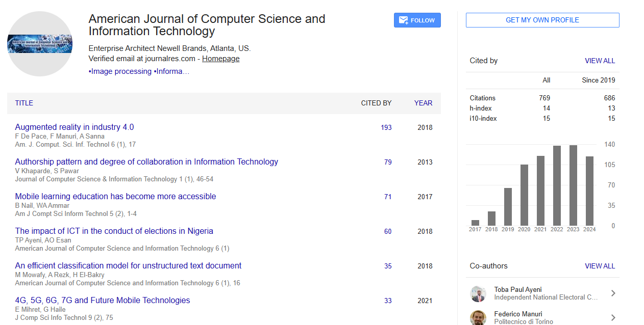
Google Scholar citation report
Citations : 769
Abstracted/Indexed in
- Google Scholar
- Genamics JournalSeek
- China National Knowledge Infrastructure (CNKI)
- CiteFactor
- Open Academic Journals Index (OAJI)
- Directory of Research Journal Indexing (DRJI)
- Jour Informatics
- CiteSeerx
- Journal Index.net
- Secret Search Engine Labs
Open Access Journals
- Aquaculture & Veterinary Science
- Chemistry & Chemical Sciences
- Clinical Sciences
- Engineering
- General Science
- Genetics & Molecular Biology
- Health Care & Nursing
- Immunology & Microbiology
- Materials Science
- Mathematics & Physics
- Medical Sciences
- Neurology & Psychiatry
- Oncology & Cancer Science
- Pharmaceutical Sciences